
Today I attended the LAMLOD Oz seminar at the HIVE at work. You can see full details of the presenters and their expertise in the link, but it is described by Eric Champion, who convened the meeting as having three main aims:
- To help Digital Humanities projects to find and develop and share tools and tutorials in Linked Open Data for Australian data.
- To learn best practice from current and developing Linked Open Data projects in Australia, especially those that cater towards non-conventional humanities data such as landscapes, cultural and historical assets such as 3D models and indigenous mapping ontologies.
- We hope to help share the news and wisdom learnt of these projects and to collaborate on ways these tools can be adapted to Australia’s unique cultural heritage and current needs. We aim to provide guidelines via a white paper published via UNESCO.
I took notes. (Using Penultimate . I started describing how, but have turned it into another post, scheduled for publishing on Monday, about Handwriting with Apple Pencil on iPad Pro for academic work.)
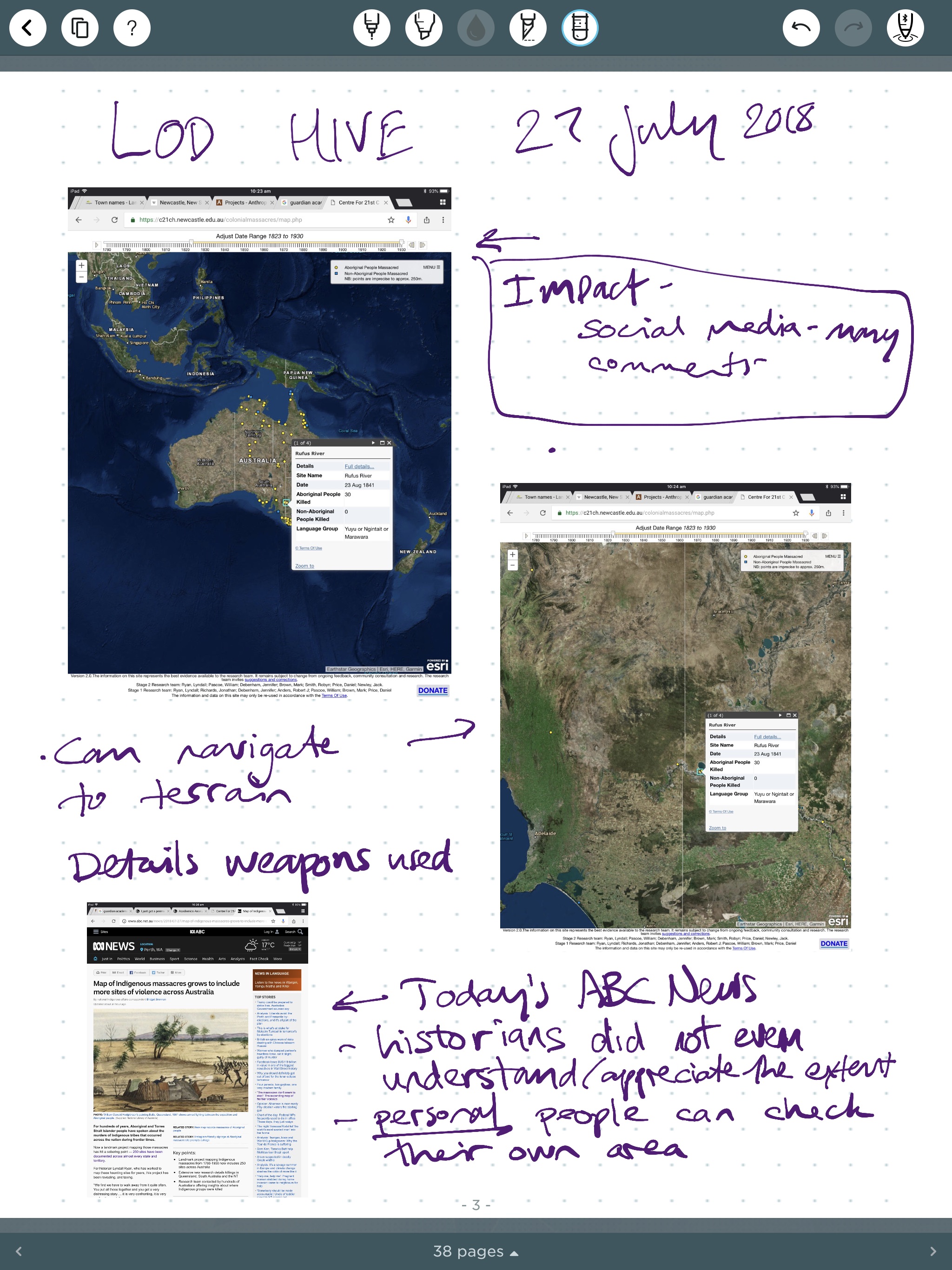
For those who asked me to share, here they are as a 42MB .PDF LAMLODGreenhillNotes2018. For some reason the last part of the day was not saved, but I did take notes of it. The resolution in this output is not really good enough to read the URLs on the webpages, which is really the reason why I inserted their images in my notes. The pages all look a bit like this (fromBill Pascoe’s session on the Colonial Massacres Map):
I came up with 15 or so questions throughout the day, marked throughout my notes. They are further thoughts or things I should follow up – some are questions from the speakers, some are my own questions. They may make sense to you as well, but their context is found in the notes above.
- Why are we not building the requirement to share data as LOD if it is produced in ARC grants / by local govt funding ?
- 1B. Why are we not checking for standards / LOD sets before we start projects and making this a requirement of any brief?
- Colonial massacre maps needed to “de-identify” the geo-coordinates of sites mapped. Some are sacred sites, some would attract people who are not well-meaning. Is there a time when NOT being accurate is an aim of a mapping exercise ? (Or are geo-coordinates less “accurate” in this case than the storytelling that can be told if information is fuzzier?
- Could an art object itself be considered to be metadata about a location?
- When looking at the accuracy of a map, does one need to ask “accurate for what”? (After Katrina Grant showed part of the Italian coast mapped for salience rather than truth. Sailors had to take a lot of extra care around this part, so coast was shown as more convoluted than it is really)
- What can be mapped? (Can we place layers of stories over landscape, and at what point do they peel away so talking about location becomes meaningless (e.g. dreaming stories …)
- 5A What if the only things *worth* mapping were those that cannot be easily mapped?
- Can we create a model of data-sharing using LOD that Jane-in-the-street (or Jane-working-in-the-public-library) will use ?
- Can’t someone make a Slurpy App that will do the hard yards if someone has geo-data in a project – harvest and link all geo-points, or in other projects analyse the entity-classes and their data and try to match what is possible to a LOD item elsewhere?
- CIDOC CRM is worth following up. And look at SKOS too while I am there.
- If we could expose the research and data behind academic writing (that becomes a narrative) through LOD, then could we argue impact to our academic institutions – or at least share with the scholarly community in a meaningful way?
- A URI is essential to create a LOD element BUT… they are fixed, static, bound. What if a concept is fuzzy, sitting between two concepts with URIs? People understand this idea very well, but computers do not..
- Given that knowledge representation is an act of interpretation (very often in Western, European, Anglo-Saxon perspective), can we use RDF to link to varied stories and alternative truths?
- Local government is crazy for standards when issuing building permits, why can they not be with their knowledge gathering? (LOD for all data generated)
- Can I use GATE for something I would like to play with ? (A corpus of documents mined and automatically matched to an ontology ) https://gate.ac.uk/2mins.html
- Does the act of knowing that someone else is viewing the same Augmented Reality scene simultaneously in the same space (and corresponding awareness of their probable emotions/mental state if viewing something likely to elicit emotions) constitute enough of an impact from environment that this would have to be considered Mixed Reality?
- Check out URIs released today here: http://catalogue.linked.data.gov.au/